Geographic situation
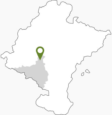
Larraga is a municipality that is in the center of the Foral Community of Navarre, in the Middle Zone or Ribera Alta
LARRAGA
Coordinates: 42°32′51″N 1°51′17″W
Larraga (1) is a municipality that is in the center of the Foral Community of Navarra, in the Middle Zone or Ribera Alta. It limits to the north with Mendigorría, to the northeast with Artajona, to the south with Berbinzana and Miranda de Arga, to the southwest with Lerín, to the east with Tafalla and to the west with Oteiza de la Solana and Baigorri. Its municipal term has an extension of 77Ž4 km2, occupying the twenty-ninth place among the municipalities of Navarre in terms of municipal extension.
In the administrative area has the category of municipality and belongs to Merindad de Olite, while in the legal has a own Court of Peace and is part of the Judicial Party of Tafalla.
Límits:
- To the north, with Mendigorría.
- To the northeast, with Artajona.
- To the south, with Berbinzana and Miranda de Arga.
- To the southwest, with Lerín.
- To the east, with Tafalla.
- To the west, with Oteiza.